As someone that is interested in the significance of space across different cultures, there are some spatial navigation questions I began to ponder…
- Firstly how can we define a map and what are the differences between physical maps, ground maps, cognitive or mental maps?
- Secondly what are the differences between western cartographic maps and non western, indigenous mapping techniques?
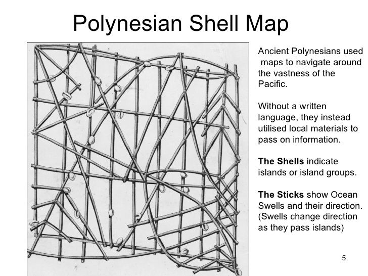
- How did traditional anthropologists and cartographers that navigated the Pacific Island seas, view the famous Stick Map Marshall Islands, Polynesia above?
- Globally how do individuals produce mental maps of their environment?
- How does human spatial behaviour, way finding and environmental perception vary cross culturally? (Great question, still exploring the answer!)
Finally how have indigenous community groups attempts to securing land rights through traditional sketch maps, adapted to more advanced technical Geographical Information Systems (GIS) digital technology?
If you are interested in any of these discussions relating to how we map our cultures, then you should enrol on the multidisciplinary Royal Anthropological Institutes Mapping Cultures Conference on Nov 8th 2014.
https://www.therai.org.uk/events-calendar/eventdetail/237/-/mapping-cultures
This is event is jointly hosted by the Horniman Museum, South London but even better, tickets are free on Eventbrite. Dont miss it.
Recent Comments